Machabée Forest Loop
Black River Gorges · Loop
Plan the Machabée Forest Loop from Pétrin in Black River Gorges. Check the route, terrain, access information and preparation before setting out.
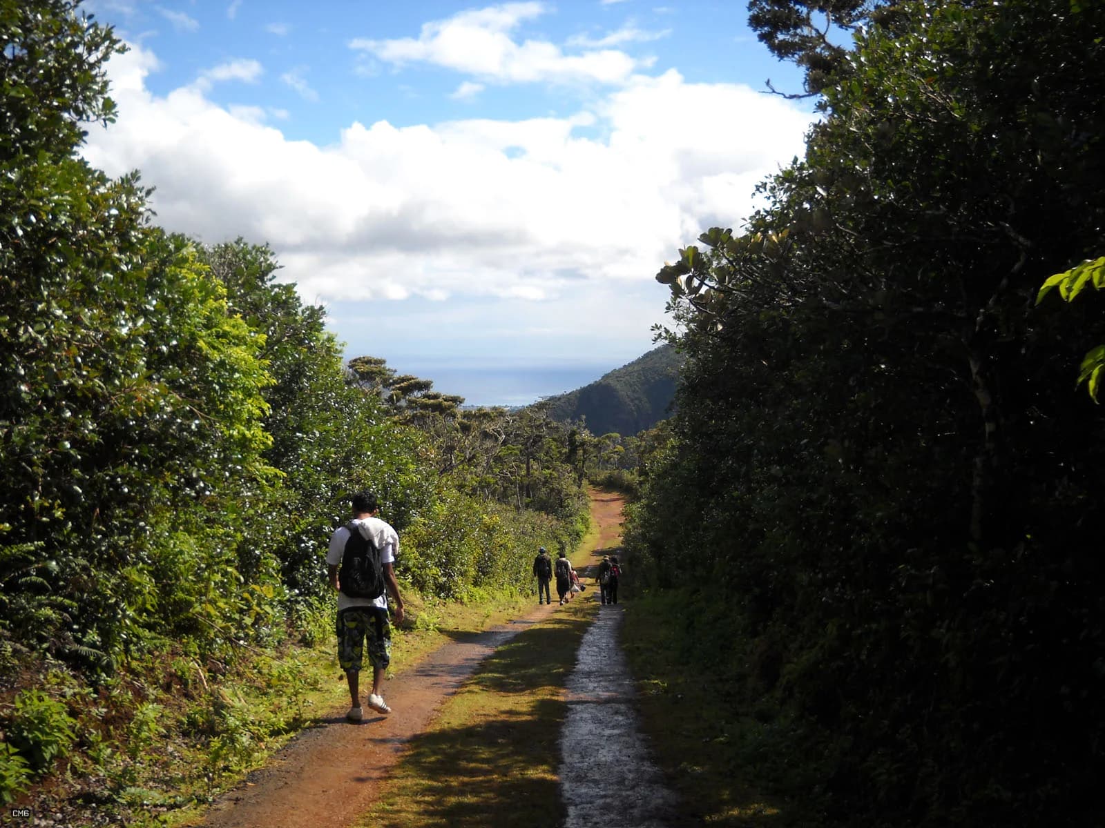
Photo by carrotmadman6 from Mauritius · CC BY 2.0 · Photo credits and edits
The route is officially listed, but current park conditions still need checking before travel.
What this walk is like
Machabée is a forest day rather than a short climb with a single dramatic finish. The official Pétrin–Machabée–Pétrin outing is long enough for walking rhythm, observation and regular pauses to matter. Choose it for time in the uplands and the changing forest, not as a quick stop between other attractions.
Route names are particularly important here. The Forest Loop returning to Pétrin and the Machabee Trail towards the lower gorges are different entries in the park inventory. A photograph labelled simply Machabée does not tell you which itinerary produced it. Keep the return point in view when comparing maps, advice or an organised outing.
This is not technically difficult, but 14 kilometres on damp forest ground is a real day out. It rewards a steady pace more than speed and can feel repetitive to hikers who only want a summit view.
Understand the terrain.
Is this hike right for you?
A good fit for
- Native forest immersion
- Longer steady walking
- Cloudier days when a summit view is uncertain
Think twice if
- A quick morning outing
- Hikers without offline navigation
- Periods of heavy rain
Which route this guide covers
Pétrin to Machabée and back to Pétrin, the 14 km Forest Loop. The separate 10 km Machabee Trail ends at Black River Lower Gorges and is not this route.
How the route unfolds
Orient yourself at Pétrin
Start by identifying the Forest Loop and its return to Pétrin on the park information available that day. Save a usable route reference and agree the intended direction with your group. This is the moment to distinguish the loop from the trail descending towards the lower gorges.
Walk into the upland forest
Settle into a pace that you can sustain for a longer outing. This is a walk to experience the forest over time rather than hurry between viewpoints. Leave space for observation and pauses while keeping track of progress and the time needed for the return leg.
Stay with the planned loop
At trail intersections, match the named direction to your chosen itinerary. A tempting descent can lead away from your return point. Do not follow a different group simply because it appears to know the way; its destination, distance and pickup arrangements may be entirely different.
Finish the return to Pétrin
Allow for the whole loop rather than treating the farthest viewpoint as the finish. Eat and drink before fatigue becomes a problem, and keep your route reference and weather layer accessible. Once back, confirm that everyone has returned and close the check-in plan with your contact.
Safety decisions
- Tell someone which loop you are taking.
- Carry an offline map and enough phone battery.
- Expect wet ground even after a dry morning on the coast.
- Do not continue through flooded stream crossings.
What to carry
- Trail shoes
- Rain layer
- Offline route
- At least 1.5 litres of water
Prepare your hike
Arrange the start, pack for the terrain and leave enough room for the return.
Open your planning sheetGetting there
Begin planning from Pétrin. Confirm the Forest Loop at the visitor area so that you do not follow the point-to-point descent.
Parking availability and current vehicle access have not been checked.
Check the park notice and your intended return time. The official route listing is not a daily access decision.
Check the planning sourceSource review 7 October 2026. This is separate from a field check.
See the trail areaAccess and timing
National park trail
The route is officially listed, but current park conditions still need checking before travel.
The official route runs from Pétrin to Machabée and back to Pétrin. Confirm current park notices before travel.
Confirm a loop back to your start
Before setting off from the Pétrin side, match your intended route with the park information available on the day. Identify the return leg and where your vehicle or pickup will be. An accidental descent towards the lower gorges creates a different transport problem from returning to the same visitor area.
Give the walk most of the day
Treat the stated walking time as time on the route, not the whole excursion from your accommodation. Add travel, orientation, food stops and a margin for slower ground. Avoid attaching a tightly timed afternoon activity to a long loop when you do not yet know your group's pace.
Make navigation independent of signal
Save your chosen route reference before leaving and carry enough battery to use it on the return. At a junction, identify the next named destination and check that it belongs to your loop. If the reference and signs disagree, resolve the uncertainty before continuing rather than hoping the paths reconnect.
Carry comfort for a longer outing
Pack a proper snack or lunch, drinking water, a light rain layer and protection for your phone. Check your footwear and deal with uncomfortable rubbing early. Leave space for a slower member of the group in your return plan. All food wrappers and other rubbish should come back with you.
Orient yourself before driving.
This pin shows the reviewed start or trail area precision stated in the guide. It is not turn-by-turn hiking navigation.
Map loads when needed
The weather at your trail.
The coordinate forecast adds rain, gust and ultraviolet context. It never changes the access status above.
Weather methodMachabée Loop
A forecast is not trail status. It cannot confirm access, stream level, rock grip, visibility or whether the route is suitable for your group.
Official warningsQuestions before you go
Is the Forest Loop the 10 km Machabee Trail?
No. The official inventory distinguishes a 14 km return Forest Loop from the 10 km trail running from Pétrin towards Black River Lower Gorges. The latter has different endpoints and is listed as strenuous. Select the itinerary before arranging transport.
Can I shorten the loop if I get tired?
A shortcut needs its own verified route and return arrangement. Do not improvise one from the map's straight-line distance. If you need a shorter commitment, choose that itinerary before starting and check its current access instead of assuming the full loop has an easy exit.
Is it worthwhile without a clear panoramic view?
The forest itself is a major reason to choose this outing. Cloud may change what you can see, but route-finding and the condition of the ground still matter. Poor visibility or weather warnings are reasons to reconsider, not an invitation to continue simply because the walk is in forest.
Compare a different kind of outing
Piton Savanne
Compare a shorter out-and-back before committing to a long forest loop.
Black River Peak
Choose a summit-oriented return route if that is the main experience you are seeking.
See what was checked, when and by whom.
Official-source review and field verification are kept separate. A recent source check does not mean the route was recently walked.
Source review 7 October 2026
One cited source supports the published record. Its review date is shown below.
Field verification not recorded
Junctions, route geometry and current trail condition still need a named field record.
What changed in this guide
Published evidence reviewed
Source reviewOfficial route, distance and classification were rechecked on 7 October 2026. Duration is a conservative planning range.
Recorded by Hiking Mauritius editorial desk
Check the evidence yourself
Official route, distance and classification were rechecked on 7 October 2026. Duration is a conservative planning range.
.jpg)