Ferney Valley 5 km Trail
South-east · Loop
A maintained five-kilometre reserve loop with modest climbing, clearer navigation and a very different risk profile from an open mountain.
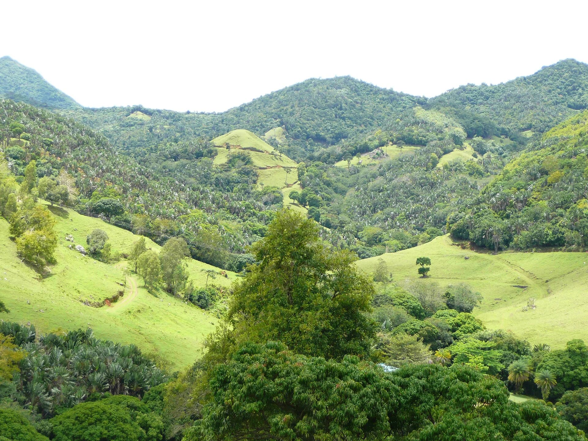
Photo by Liné1 · CC BY-SA 3.0 · Photo credits and edits
Paid admission, operating hours, route start times and event restrictions apply.
What this walk is like
Ferney's five-kilometre Route 01 is a managed walk on open tracks. Its appeal is a defined outing within a reserve, with entry and route choice arranged before you begin. It is a different proposition from finding an informal mountain approach or negotiating a rocky summit finish.
Choose the five-kilometre route for a shorter introduction to the valley. Longer circuits are separate commitments, not optional extras to add casually halfway through the walk. If your main interest is interpreting plants and conservation work, ask the reserve what a guided visit includes; the self-guided track and the guided nature visit need not be the same experience.
Ferney is the easiest recommendation when someone wants nature without route-finding or scrambling. The trade-off is paid, time-controlled access and a sun-exposed track rather than a wild summit trail.
Understand the terrain.
Is this hike right for you?
A good fit for
- Families and beginners
- Wildlife and conservation context
- Visitors who value maintained tracks
Think twice if
- Visitors seeking a free trail
- A late spontaneous start
- Hikers looking for a rocky summit
Which route this guide covers
The manager’s Route 01, the 5 km open-track walk. Longer 8, 13 and 18 km options are separate routes.
How the route unfolds
Check in and choose Route 01
At reception, confirm the five-kilometre circuit, its start deadline and the day's instructions. Clarify the route's return and any facilities you intend to use. If you want a longer walk, choose it now because Ferney's other circuits have different durations and latest starts.
Follow the open-track circuit
Route 01 is the manager's easy five-kilometre option with 75 m of stated ascent. Follow the route information provided at check-in instead of drifting onto a longer circuit. Keep a pace that leaves room to notice the valley rather than treating the published time as a target to beat.
Manage sun and pauses
The manager identifies this route as sun-exposed. Keep drinking water and sun protection accessible, and pause according to the group's needs. A short, low-ascent outing can still be uncomfortable in heat. Observe plants and wildlife without leaving the permitted track or expecting a particular sighting.
Return and report back as instructed
Complete the selected circuit and follow reception's checkout instructions. Meals, guided wildlife visits and other reserve activities are separate arrangements unless explicitly included. Check what is available before building the rest of your day around an assumed extra.
Safety decisions
- Book ahead when access may be limited.
- Carry sun protection and water.
- Respect the route start deadline.
- Use the reserve emergency contact if assistance is needed.
What to carry
- Closed sport shoes
- Sunblock and hat
- Water
- Mosquito repellent
Prepare your hike
Arrange the start, pack for the terrain and leave enough room for the return.
Open your planning sheetGetting there
Arrange entry through La Vallée de Ferney and confirm reception instructions when booking.
Ask reception about current parking arrangements.
Paid admission applies. The manager recommends advance booking and states a latest start of 14:00 for the 5 km route. Check the intended date for private-event restrictions.
Check the planning sourceSource review 7 October 2026. This is separate from a field check.
See the trail areaAccess and timing
Paid reserve access
Paid admission, operating hours, route start times and event restrictions apply.
The reserve states that activities run from 8:30 to 14:00. The five-kilometre route should start by 14:00. Access can be limited for private events, especially from June to September, so advance booking is sensible.
Book the route you intend to walk
Confirm Route 01, the date, the reception instructions and any event restrictions with Ferney. Check the current admission price directly when booking. Tell reception about your group's needs before arrival rather than assuming every route has the same surface or accessibility.
Respect the route's start deadline
Use the start time for the five-kilometre walk, not the reception's closing time. Leave room for arrival, check-in and pauses. If you want a longer circuit, book and plan it separately because the manager gives different latest starts for different route lengths.
Prepare for open sun
Carry drinking water, a hat and sun protection where you can reach them easily. Closed shoes, a light layer and insect repellent belong in the plan too. An easy track can still feel tiring in heat. Choose a pace that leaves everyone comfortable for the return rather than treating the short duration as a race.
Clarify the return arrangements
At check-in, ask how the selected route returns, where to report back and which contact to use if you need help. Save the manager's current contact details before starting. Do not assume a vehicle pickup, refill point, meal or wildlife activity is included unless the reserve confirms it.
Orient yourself before driving.
This pin shows the reviewed start or trail area precision stated in the guide. It is not turn-by-turn hiking navigation.
Map loads when needed
The weather at your trail.
The coordinate forecast adds rain, gust and ultraviolet context. It never changes the access status above.
Weather methodFerney 5 km
A forecast is not trail status. It cannot confirm access, stream level, rock grip, visibility or whether the route is suitable for your group.
Official warningsQuestions before you go
How does the five-kilometre walk differ from the longer routes?
The manager lists distinct circuits with different durations, ascent and start deadlines. This guide covers Route 01. Moving to a longer option changes the commitment, so select it with reception before setting out rather than extending the walk by guesswork.
Are wildlife sightings part of the guarantee?
No. A reserve visit is an opportunity to observe habitat, not a promise that a particular animal will appear. If you want a guided wildlife experience, check its actual programme and availability with the reserve. Keep that separate from admission to a walking track.
Can I arrive whenever reception is open?
Reception hours and route start times are different. Confirm the latest start for your chosen circuit and allow time to check in. Private events and date-specific restrictions can also affect access, so advance confirmation is useful even for the shortest walk.
Compare a different kind of outing
Piton Savanne
Compare a national-park walk of similar scale, with a different access and navigation framework.
Le Pouce
Compare a central mountain outing if the group wants a shoulder viewpoint and can assess steeper terrain.
See what was checked, when and by whom.
Official-source review and field verification are kept separate. A recent source check does not mean the route was recently walked.
Source review 7 October 2026
One cited source supports the published record. Its review date is shown below.
Field verification not recorded
A named route-version field record has not yet been attached.
What changed in this guide
Published evidence reviewed
Source reviewThe reserve's current route facts, opening times and access notes were rechecked on 7 October 2026.
Recorded by Hiking Mauritius editorial desk
Check the evidence yourself
The reserve's current route facts, opening times and access notes were rechecked on 7 October 2026.