Le Pouce
Moka Range · Out and back
A central mountain walk with a grassy shoulder and a short, steeper final push to a small summit.
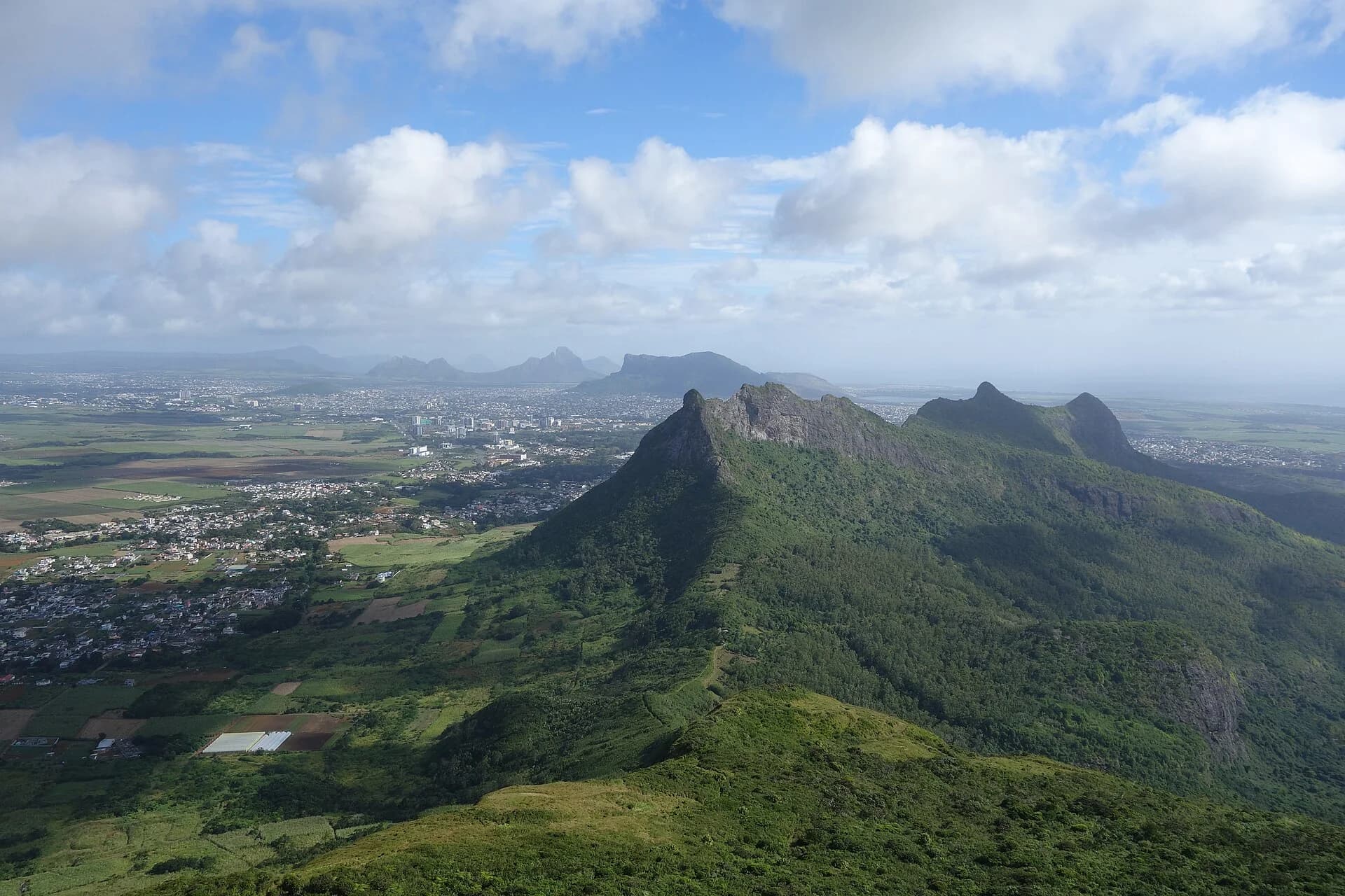
Photo by Luka Peternel · CC BY-SA 4.0 · Photo credits and edits
No current land-manager confirmation has been verified for the approach used in this guide.
What this walk is like
Le Pouce is a central mountain outing with a useful natural decision point below its small summit. The lower walk and shoulder give a different experience from the short, steeper finish. Discuss those two objectives before leaving, especially if your group includes first-time mountain walkers or anyone uncertain about height.
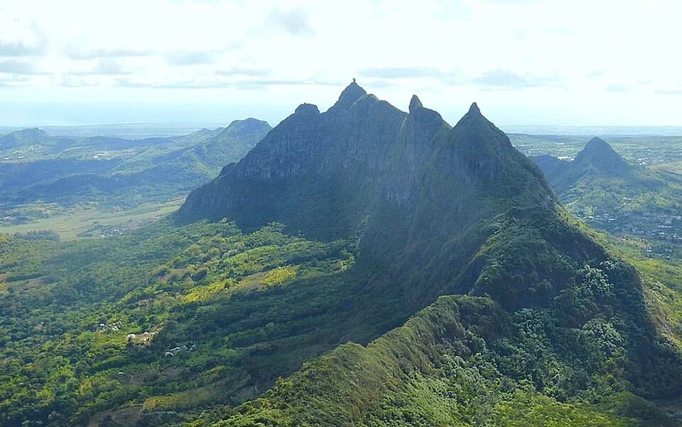
The mountain is known for its thumb-shaped outline and views towards Port Louis and the surrounding Moka landscape. Treat the panorama as weather-dependent. A good day here can be a measured walk to a comfortable stopping point, with enough time to enjoy the landscape and descend without rushing.
Le Pouce is often called easy, but the word can mislead beginners. Most of the route is approachable, while the summit finish is steeper, narrower and more exposed. You can stop below it and still have an excellent view.
Understand the terrain.
Is this hike right for you?
A good fit for
- Views over Port Louis and the central plateau
- A first non-technical mountain
- Hikers happy to stop below the final summit
Think twice if
- Strong wind or low cloud
- Anyone expecting full trail signage
- People who feel pressured to complete the final summit
Which route this guide covers
A planning brief for Le Pouce, with the shoulder and summit treated separately. The cited tourism article does not establish a surveyed approach or exact trailhead.
How the route unfolds
Begin on the approach you confirmed
Use one agreed approach and keep its return arrangement clear. The tourism distance in this guide is planning context rather than a surveyed route from every possible start. At the beginning, check your orientation, shoe grip and the group's pace before moving onto steeper ground.
Reach the shoulder at a comfortable pace
The lower walk leads towards the shoulder beneath the thumb-shaped summit. Take time here to enjoy the broader landscape and reassess the outing. A pause below the final climb lets you judge wind, visibility and confidence without making the summit feel like an obligation.
Decide whether to take the summit finish
The last part is steeper, narrower and more exposed than the approach. Look at how comfortably everyone can also descend it. Do not continue simply because the top appears close. Choose a lower finish if anyone is uneasy, and keep the return plan shared by the whole group.
Descend without rushing
Give the descent the same attention as the ascent. Allow space on steep ground, stop before using your phone and keep the group together at junctions. Return by the approach you planned; a path heading towards another settlement is not an interchangeable way back to your transport.
Safety decisions
- Avoid the summit in strong wind or poor visibility.
- Download the route before arrival.
- Do not rely on informal shortcuts.
- Leave room for other hikers on the small summit.
What to carry
- Shoes with grip
- Offline route
- Water
- Wind layer
Prepare your hike
Arrange the start, pack for the terrain and leave enough room for the return.
Open your planning sheetGetting there
Confirm the approach with the relevant land manager before driving. This guide does not claim a verified start point.
The parking location and permission to use it remain unverified.
No current land-manager access confirmation or entrance conditions are recorded. Use the source for mountain context, not permission.
Check the planning sourceSource review 7 October 2026. This is separate from a field check.
See the trail areaAccess and timing
Current approach needs a field audit
No current land-manager confirmation has been verified for the approach used in this guide.
There is no single managed visitor gate. Confirm the approach, weather and parking situation before leaving.
Agree one approach and one return
Ask your local contact to identify the exact approach, access basis and parking or pickup arrangement. Keep those instructions with your plan. Do not combine the start from one online account with the distance from another, or assume a road visible on a map is an authorised entrance.
Separate the shoulder from the summit
Make the shoulder a place to reassess the group. Consider footing, wind, visibility and how each person feels about the descent. Anyone who does not want the steeper finish needs a clear plan with companions; do not split the group without an agreed meeting and return arrangement.
Leave time to come down carefully
Use the guide's planning range rather than copying a fast ascent time. Reserve energy and daylight for the return. A section that felt manageable going up can feel quite different facing downhill. Keep the pace within the least comfortable member's ability instead of pushing to keep a later appointment.
Travel light without omitting essentials
Carry water, food, sun protection and a weather layer in a small backpack. Keep your phone charged and your route reference saved offline. Choose shoes that hold well on uneven ground. Take any extra summit decision while you still have spare time and energy, not at the point of fatigue.
Orient yourself before driving.
This pin shows the reviewed start or trail area precision stated in the guide. It is not turn-by-turn hiking navigation.
Map loads when needed
The weather at your trail.
The coordinate forecast adds rain, gust and ultraviolet context. It never changes the access status above.
Weather methodLe Pouce
A forecast is not trail status. It cannot confirm access, stream level, rock grip, visibility or whether the route is suitable for your group.
Official warningsQuestions before you go
Is Le Pouce an easy family walk?
The shoulder and summit should be assessed separately. The last part is steeper and more exposed than the lower walk. The tourism source's family context is not a blanket recommendation for every child, and this guide does not set an unsupported minimum age.
Can I start from either side and use these figures?
No. Distance and effort depend on the approach and finish. The figures here are broad tourism planning context, not a surveyed route for every starting point. Confirm the variant first, including where you will return and how you will get home.
Can I combine Le Pouce with Pieter Both on foot?
Do not treat the neighbouring peaks as one ordinary hiking itinerary. Pieter Both's summit involves a different technical objective, and this guide does not provide a verified connecting route. Plan them separately with the appropriate access and leadership.
Compare a different kind of outing
Piton Savanne
Compare an officially listed walking route if avoiding the steeper summit finish matters most.
Pieter Both
Read the technical overview only if you are seeking a specialist climbing objective, not an extension of Le Pouce.
See what was checked, when and by whom.
Official-source review and field verification are kept separate. A recent source check does not mean the route was recently walked.
Source review 7 October 2026
One cited source supports the published record. Its review date is shown below.
Field verification not recorded
Access, parking, route variant, signage and imagery all need a named field record.
What changed in this guide
Published evidence reviewed
Source reviewTourism authority distance, duration and elevation were rechecked on 7 October 2026. The access note still needs a formal field audit.
Recorded by Hiking Mauritius editorial desk
Check the evidence yourself
Tourism authority distance, duration and elevation were rechecked on 7 October 2026. The access note still needs a formal field audit.