Pieter Both
Moka Range · Out and back with climbing sections
A serious ascent that moves from steep hiking into exposed rope-assisted climbing below the island's famous boulder summit.
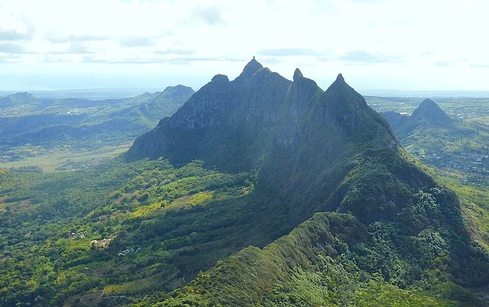
Photo by Happolati · CC BY-SA 4.0 · Photo credits and edits
No current land-manager confirmation has been verified for the approach used in this guide.
What this walk is like
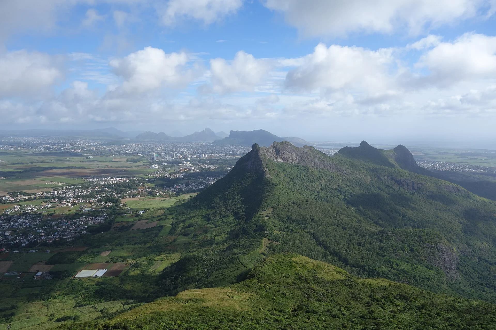
Pieter Both is recognisable by the boulder that forms its summit. The important distinction for planning is between approaching the mountain and undertaking the protected upper climb. A modest distance does not capture the time spent fitting equipment, moving under supervision and managing the descent.
Treat the summit as a specialist objective with an agreed leader and turnaround plan. This guide describes its character so you can decide whether to investigate further; it is not a climbing manual or an independent route description. Someone who enjoys long walks may still find exposed climbing uncomfortable, and that is worth discussing before any booking.
Pieter Both should not appear in the same difficulty list as a hard walking trail. Reaching the summit requires technical systems and judgement. Fitness alone does not replace climbing competence, equipment or weather discipline.
Understand the terrain.
Is this hike right for you?
A good fit for
- Experienced hikers seeking a guided technical objective
- People comfortable with rope systems and exposure
- Dry, stable weather
Think twice if
- Independent first-time climbers
- Wet or windy conditions
- Anyone unsure about heights
Which route this guide covers
A technical overview using the currently cited 3.3 km guided summit itinerary. Its figures do not apply to every approach or to a lower walk.
How the route unfolds
Meet the leader and confirm the objective
The cited programme meets at La Laura Football Pitch. Treat that as an organised meeting point, not proof of a public trailhead. Confirm the day's access, route, equipment and return plan before beginning. Everyone should understand the difference between the approach and the protected summit climb.
Walk the lower mountain approach
The operator describes an approach through forest before the upper rocky section. Use this part to settle the pace and communicate any discomfort early. Save energy for the technical part and the descent; the short advertised distance does not measure the whole effort of the outing.
Reassess before protected climbing
The upper objective involves ropes, a harness and suitable protection managed by a competent leader. Equipment checks, supervision and weather decisions belong here, before committing further. This guide provides no anchor, rope or climbing instructions and should not be used to attempt that section independently.
Treat the descent as part of the climb
The summit boulder is a stopping point within the outing, not the end of the leader's responsibility or the group's effort. Keep the agreed supervision and technical arrangements for coming down. Finish with the planned return to the meeting or pickup point rather than assuming the descent will be quick.
Safety decisions
- Do not treat an old fixed rope or metal fitting as proof that it is safe.
- Use a helmet, harness and an appropriate rope system for the upper section.
- Turn around if rock is wet, cloud is building or wind is increasing.
- Keep the group small enough for close supervision.
What to carry
- Helmet and harness
- Appropriate rope and protection system
- Shoes with strong grip
- Water, food and weather layer
Prepare your hike
Arrange the start, pack for the terrain and leave enough room for the return.
Open your planning sheetGetting there
Agree the exact approach, permission and meeting arrangements with a competent route leader.
No independently checked public parking location is recorded.
Technical leadership does not establish permission. Confirm both the proposed route and its access basis.
Read the dated Pieter Both access and conditions report before planning your outing.
Check the planning sourceSource review 22 July 2026. This is separate from a field check.
See the trail areaAccess and timing
Unmanaged mountain approach
No current land-manager confirmation has been verified for the approach used in this guide.
The summit is a climbing objective, not a normal hiking finish. The upper section requires protection, suitable equipment and someone competent to use it.
Describe your experience honestly
Tell the proposed leader about your experience of heights, steep descents and roped activity. Ask how the group will be supervised and what ability is expected before starting. Fitness and enthusiasm are useful, but neither answers whether the technical sections suit you.
Confirm the equipment and leadership
Ask what protective equipment is supplied, how fit is checked and who manages the technical decisions. Confirm arrangements for both ascent and descent. Do not rely on the presence of old fixed equipment, another climber's video or a packing list as a substitute for competent supervision.
Keep the whole day flexible
The current operator-described itinerary is only one version of the outing. Confirm its meeting point, route, duration and return with the organiser. Add travel and preparation time to the advertised activity. Avoid an inflexible onward commitment that could create pressure to hurry a technical descent.
Agree when to stop
Discuss weather limits and the point at which the group will reassess before the upper climb. Confirm what happens if someone is uncomfortable or conditions change. Choosing to turn around should be part of the original plan, with a supervised return, rather than an argument made under pressure on the mountain.
Orient yourself before driving.
This pin shows the reviewed start or trail area precision stated in the guide. It is not turn-by-turn hiking navigation.
Map loads when needed
The weather at your trail.
The coordinate forecast adds rain, gust and ultraviolet context. It never changes the access status above.
Weather methodPieter Both
A forecast is not trail status. It cannot confirm access, stream level, rock grip, visibility or whether the route is suitable for your group.
Official warningsQuestions before you go
Can a fit hiker attempt the summit independently?
Fitness does not establish climbing competence, permission or a suitable protection system. This page does not equip an independent visitor to attempt the summit. Arrange competent technical leadership and confirm the route and access before considering the outing.
Why are the route figures tied to an organised itinerary?
The current source describes a specific guided programme, not a surveyed universal route. Other meeting points or objectives may change its length and timing. Keep the cited figures with that programme instead of applying them to every Pieter Both approach.
Is reaching the shoulder automatically a non-technical alternative?
No. It still needs its own assessment of approach, exposure, access and return. Do not assume that stopping below the summit makes an unfamiliar mountain suitable. Discuss any lower objective with a competent local leader before setting out.
Compare a different kind of outing
Le Pouce
Compare a neighbouring mountain walk with a distinct summit decision, rather than a protected climbing objective.
Black River Peak
Compare a longer walking route if endurance and forest terrain appeal more than technical climbing.
See what was checked, when and by whom.
Official-source review and field verification are kept separate. A recent source check does not mean the route was recently walked.
Source review 7 October 2026
One cited source supports the published record. Its review date is shown below.
Field verification not recorded
The approach, protection system and technical route need an approved named field record.
What changed in this guide
Published evidence reviewed
Source reviewThe cited operator itinerary was rechecked on 7 October 2026 and now states 3.3 km, 450 m ascent and about 4 hours. These are programme-specific figures, not a field-surveyed route. Technical decisions belong to the competent leader on the day.
Recorded by Hiking Mauritius editorial desk
Check the evidence yourself
The cited operator itinerary was rechecked on 7 October 2026 and now states 3.3 km, 450 m ascent and about 4 hours. These are programme-specific figures, not a field-surveyed route. Technical decisions belong to the competent leader on the day.